The two weeks of observations and data collection at the Fixed Point centred on 72º45’N 168º15’W were completed today, 25 September. The researchers onboard are very happy with the results. During our stay in this area several cyclone centres have passed directly over our position, ensuring the Senior Met Officer’s project was more than successful. With the dozens of CTD rosette, plankton net hauls and other casts a fascinating in depth sequence of changes has been noted. Shigeto Nishino’s group have been very excited with the results. A number of theories on sea water distribution of the Pacific and East Siberian surface water may have been confirmed if not at least provided with more supporting evidence. Other new theories have been postulated.
The last chance hope to occupy the Chukchi Abyssal Plain (CAP) mooring site at 72º12’N 172º33’W to the northwest was finally put to rest today. The Chief Scientist had never fully discounted the change that we might see conditions suitable to recover and redeploy the sediment trap mooring placed last year. We have been carefully studying the ice information coming in over the last few days to make the decision. The CAP location, almost about a half day’s steam from our present position demanded high assurance that the site would be sufficiently ice free to conduct the 4-5 hours recovering of the present mooring and deployment of the replacement. Given the few days remaining in the cruise, wasting a day steaming to and from a station that was important, but not vital only to find it ice covered could result in other stations being lost to the ice that is now advancing daily.
The ice information available could not give sufficient assurance of an ice free sea. The NATICE Chukchi chart did not cover the position. The thrice weekly NOAA sea ice charts showed the position on or north of the primary pack ice edge and the ice edge progressively advancing southward. The small scale TOPAZ and AMSR2 charts provided little clear definition with sufficient resolution to ensure the position was clear. In the latest MODUS satellite high resolution visual image the CAP position was obscured by cloud cover thus provided no usual information and a low resolution Radarsat image received onboard stopped 15-20 miles south of CAP. The latest AMSR2 sea surface temperature based chart tipped the scale. It indicated the dreaded “blue band” of no sea surface temperature recorded south of the pack ice edge and over the CAP position, the lack of temperature reading assumed to be a sign of significant ice cover. After consultations between the Ice Navigator, the Captain and the Chief Scientist, the call was made to continue with the Plan B option and steam north to 74ºN.
There remains plenty of work to do in the final two weeks. We will continue to move northward towards the ice pack to compete observations in stations along 74ºN as yet still unencumbered by ice, but expected to be soon. We will return to the area of Point Barrow to attempt recovery of moorings that remain there, then finally steam to occupy stations along the 168º45’ meridian that were deferred at the beginning of the cruise.
Capt David (Duke) Snider
Ice Navigator
RV Mirai
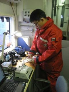
Photo: Senior Met Office Jun Inoue calibrates a radiosonde before launch.