31 August and science has begun in earnest. Mirai cruise 13-06 stn 001 was conducted just outside the US 3 mile limit to the east of Little Diomede Island. Under sunny skies, winds NE15 and a slight 1m swell four separate casts were conducted In relatively shallow depths of 52m, the casts went quickly. First a PRR (spectroradiometer) cast from the stern, followed each in turn by an HydroScat (spectral backscattering sensor), a NORPAC plankton net cast and the full 36 Niskin bottle CTD (Conductivity Temperature Depth) rosette from the starboard side. The massive CTD rosette is the most impressive to watch swung over the side by the purpose built Dynacon 3 ton articulated crane. Once brought onboard the rosette is moved back into the #1buoy shed water sampling room and is soon surrounded by technicians taking the required sample sets from each bottle.
For those less familiar, the purpose of the rosette is to be sent to the planned depth, then on the way up specific bottles are triggered to close at certain depths, taking samples for that depth. These are then compared to the continuous data feed from the CTD sensors that are also onboard the rosette. Individual bottles samples are broken down into smaller sub samples for individual research projects.
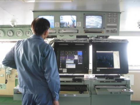
The Captain generally remains in charge of manoeuvring throughout the occupation of the stations using the joy stick control linking the twin bow thrusters, single stern thruster and twin shafts. An “older ship” as First Officer Ken Matsamura MNI (Lucy, you may want to check what his grade actually is) says, RV Mirai is not DP rated, but enjoys at least the ease of single joy stick control. Ken-san tells me the ship is very responsive with plenty of power at one’s finger tips.
Assessment of the ice conditions ahead continues daily and the strategic plan for the science program amended as information on ice conditions changes. The Ice Navigator is constantly comparing the different data sources, knowing that depending on the source of information for each chart, the timeliness of that data and the method of construction, each chart is more or less accurate for a given point in time. The Ice Navigator’s informal evening discussion with the Chief Scientist tends to discuss broad possibilities for selection of stations to occupy over the coming days, while morning briefings with the Captain are more specifically on routing between the Chief Scientist’s preferred station positions.
Completing the first three stations across the Bering Strait from Little Diomede Island to Cape Prince of Wales, the ship then turns back to her northbound track, working stations every 30 minutes of latitude along the 168º45’ meridian.
photo: Captain Yoshiharu Tsutsumi maintains position using joystick control during occupation of Bering Strait science station